Next Workshop
Centro Cultural de España Juan de Salazar - Asunción, Paraguay
Pro Area

UPCOMING COURSE
Realidad Aumentada con QR codes & geolocalización.

Locative Storytelling Workshops Archive
2014
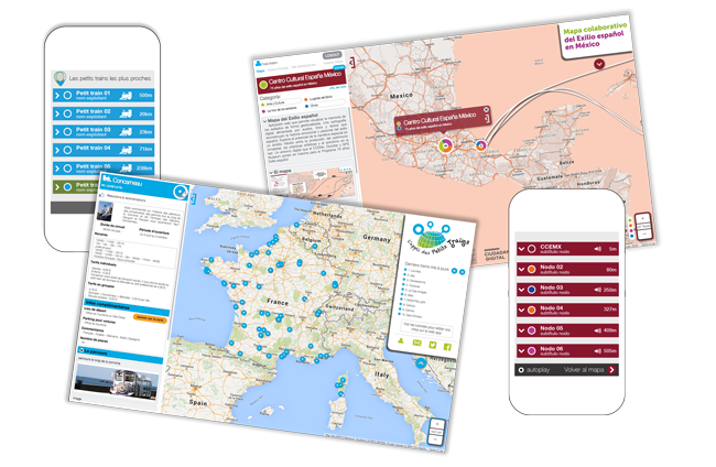
Mapa Colaborativo: 75 años del Exilio Español
Impartido por el colectivo Escoitar y el Lab GPS Museum


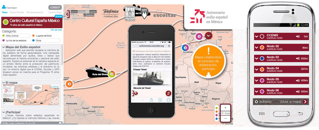
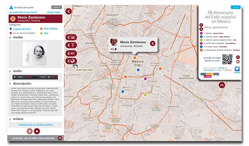
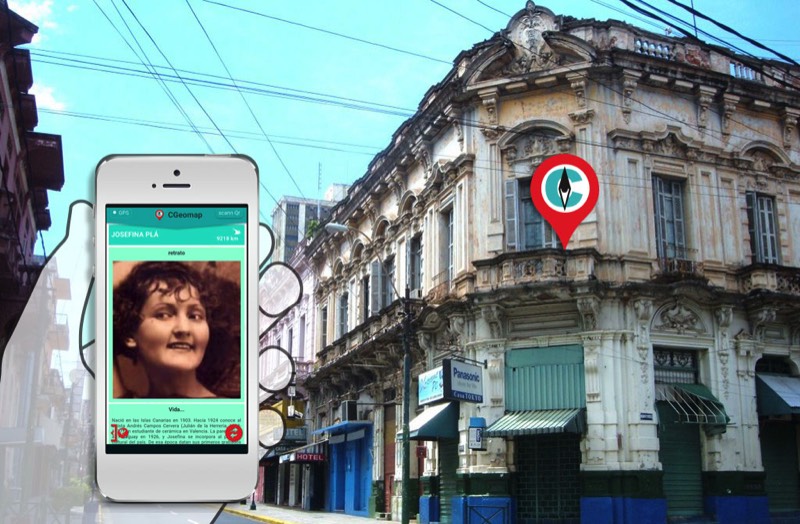
La creación del mapa colaborativo 75 años del Exilio Español es fruto de la voluntad del Centro Cultural de España en México DF (CCEMX), resultado del deseo de crear un entorno digital interactivo y colaborativo para la escritura abierta, común y plural en conmemoración del 75 aniversario (en 2014) del exilio Español hacia México. Se plantea como un mapa navegable de la ciudad que es el interfaz de la creación misma y que es, soporte y contexto para esta escritura sobre la historia pasada y presente del exilio, vinculada al espacio real. Las memorias se descubrirán y experimentarán desde el móvil paseando por la ciudad y/o desde cualquier ordenador conectado a internet.
CCEMX
El objetivo principal del taller es colaborar en la creación del mapa colectivo del 75 aniversario del exilio español en México puesto en marcha por el CCEMX. Durante el taller se abordarán el potencial de la narrativa espacial y de los Locative Media en un contexto cultural. También se trabajará sobre la idea de la representación de los procesos culturales a través de su manifestación sonora como formas de transmisión de conocimiento en el contexto de la Fonografía. Durante las sesiones se hará una introducción a proyectos y estrategias que permitan definir una metodología de trabajo en grupo con la finalidad de generar contenidos audiovisuales.
2013

Présentation du jeu
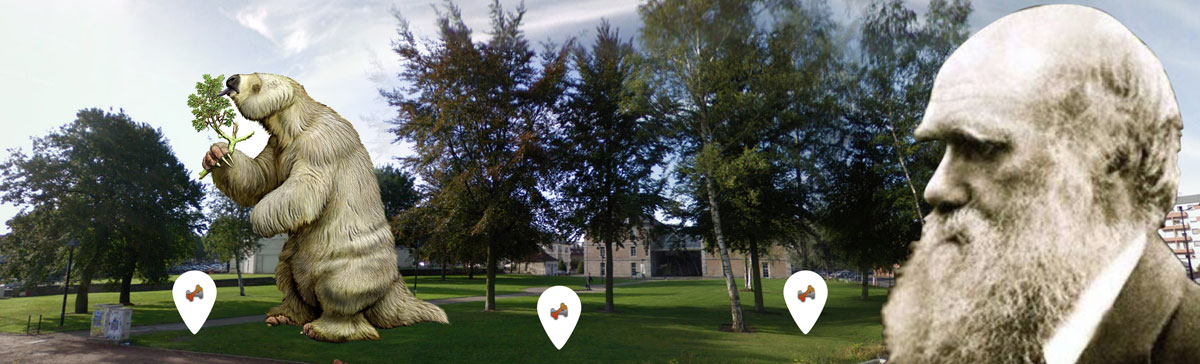
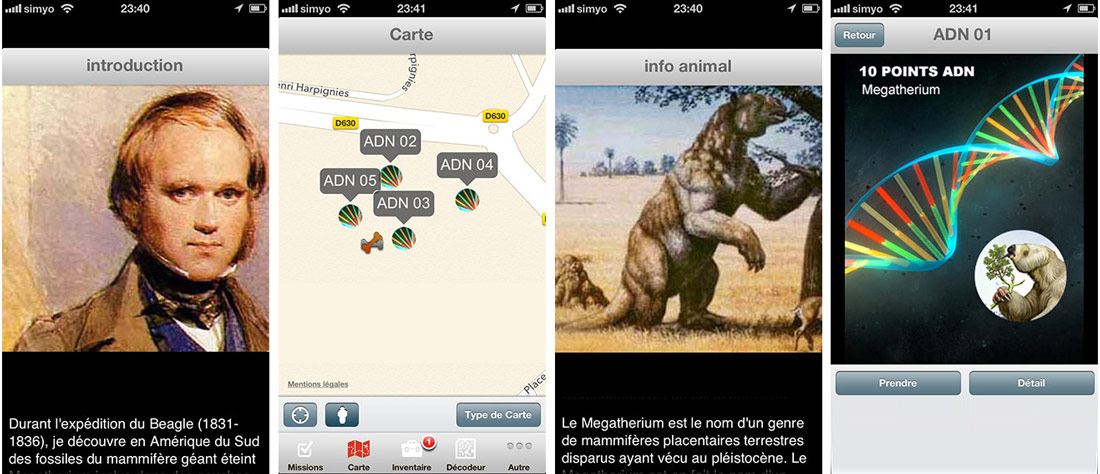
Darwin réalisa un voyage emblématique à bord du Beagle vers les côtes de l'Amérique du Sud en 1839. Il découvrit tout au long de son périple de plus de 5 ans de nombreux indices archéologiques qui lui permettront d'élaborer sa théorie sur l'évolution des espèces. De nombreux ossements de Megatherium, un paresseux Géant aujourd'hui éteint de plus de 5 mètres de haut, sont enfouis dans la zone de jeu. Equipés de smartphones Iphone et Ipad, les joueurs-explorateurs doivent trouver en un temps record un maximum d'ADN de cet animal géant.
GPSM Lab
2011
MICROCOSMOS EXPLORER
with ARIS Games & Keeploop
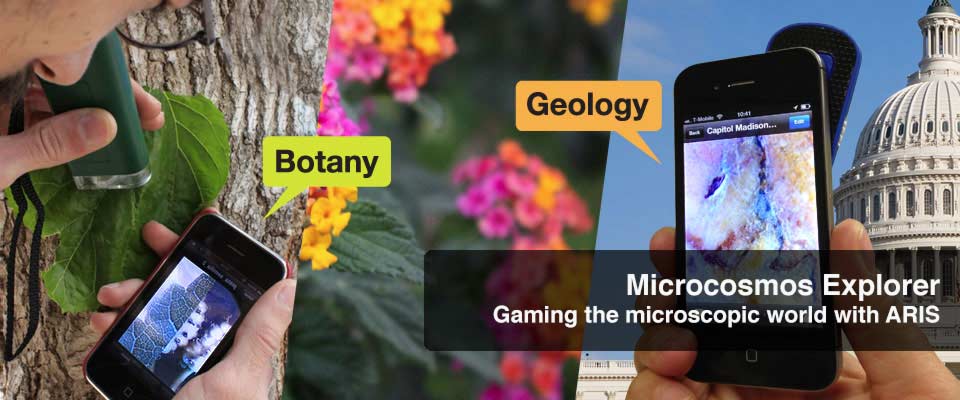
Microcosmos Explorer is a Locative Game where you have to help the french botanist Gaston Bonnier to plant seeds at the right place in a botanic garden. You will have to use a microscope to play with the ARIS Games adventure app.
GPS Museum Lab
Gaming the Microscopic World with Smartphones
Presentation of the game
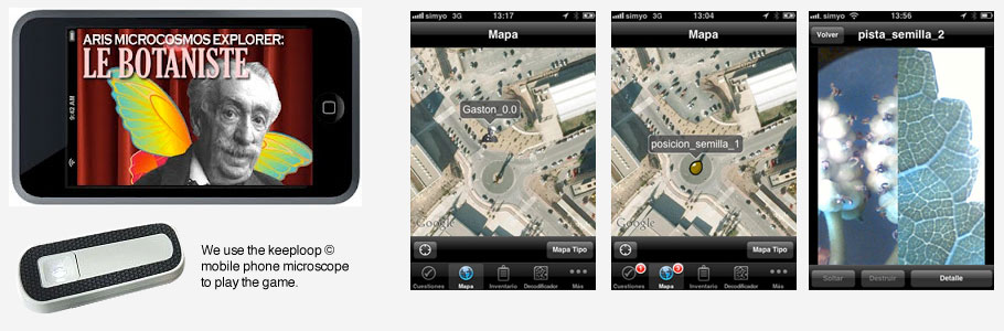
Small gardens with plants from different geographical areas grow at the University of Murcia, Espinardo Campus. In this game developed on the ARIS platform, three of these gardens are used to play the game: the Eastern Mediterranean, the Rose Garden and the Garden of the Hesperides. These three areas are linked by a greenway, which can be accessed by bike or on foot. The guide for this game is a posthumous avatar of the botanist and educator Gaston Bonnier, who tells us where to find seeds on the campus. Once we get the seeds, we receive instructions for planting them in the most appropriate place. Gaston teaches us to recognize the different flora families on the campus and show us how to improve our perception. He give us microscopic images of plant leaves which we must be matched to their sources to determine the best place to sow our seeds.
GPSM Lab
The game: 1- Catch the seeds lost on the floor by the french botanist Gaston Bonnier 2 - Find the right place to plant the seeds 3- Compare the plants with the digital samples on your smartphone with the help of your microscope.
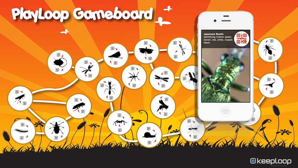
We use diagrams with micro QR codes, a original concept by Keeploop.
Superuser